
|
| Start | Previous image | Next image | End |
|
|
|
|
|
|
|
Item
Number: 1970:02007.16
Date of
map: 1677
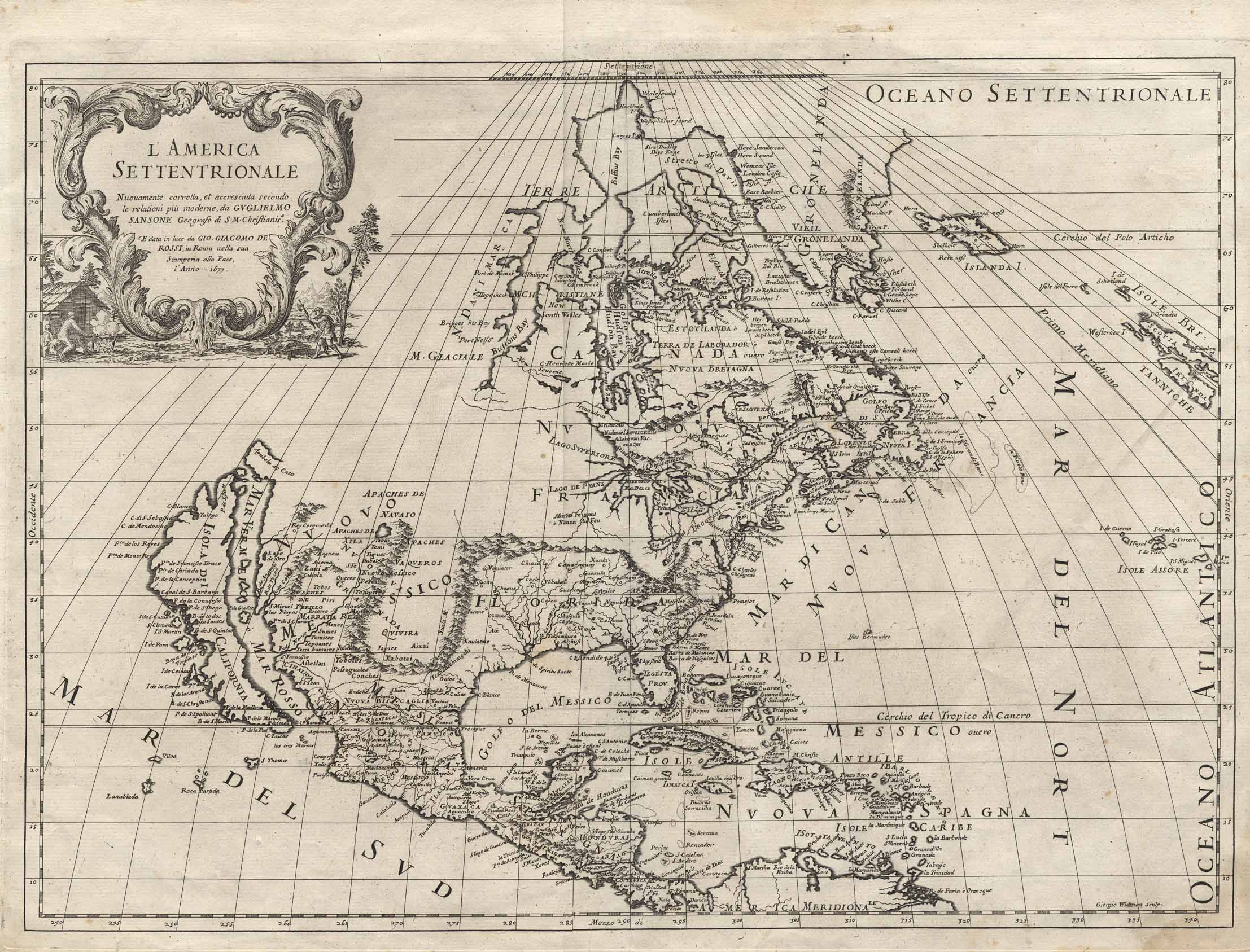
Title:
L'America
Settentrionale, nuouamente corretta, et accresciuta secondo le relationi pui
moderne, da Guglielmo Sansone geografo an SM Chriftianis
Cartographer
(personal name): Sansone, William
Height
(inches): 18
Width (inches): 24
This map of North
America and part of the British Isles shows the locations of some Indian and a
few Spanish settlements. Shows
the prime meridian, mentions the Seven Cities
of Cibola, mentions the legendary Quivara (an alternative name for
southwestern North America), and shows Greenland as a peninsula.
Canada is labeled in part as New France.
Shows California as an island. The
central part of North America and everything north of 45 degrees North and
west of the Great Lakes and Button's Bay are not mapped.
Curved projection.
This
map forms part of the Cutter World Map Collection, collection C 003, at the Center of Southwest Studies, Fort Lewis
College.
© 2003 Center of Southwest Studies,
Fort Lewis College
All rights reserved (click here for Property Rights Statement).
1000
Rim Dr., Durango, CO 81301-3999 ~ Phone
970-247-7126 ~ Fax 970-247-7422
Page revised: November 14, 2003