
|
| Start | Previous image | Next image | End |
|
|
|
|
|
|
|
Item
Number: 1970:02007.14
Date of
map: 1796
Place
of publication: Venice
Title:
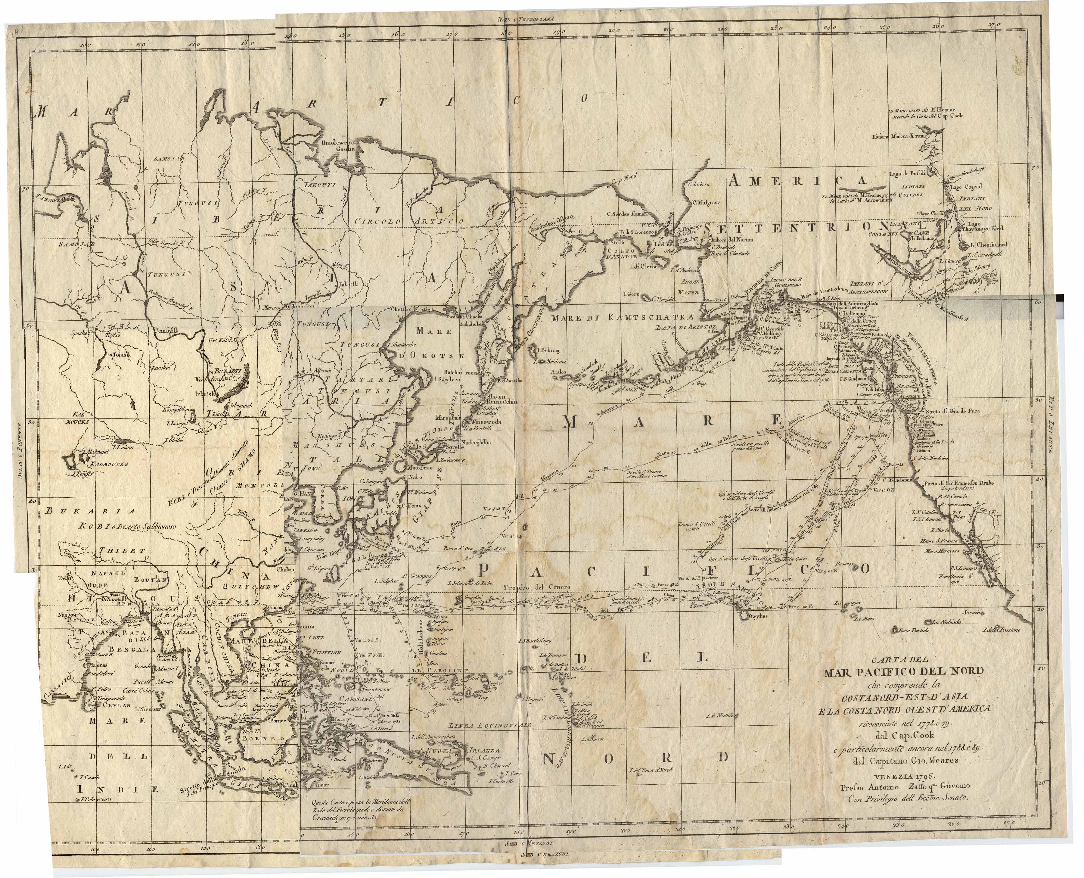
Carta
del Mar Pacifico del Nord [map of the North Pacific]
Cartographer
(personal name): Zatta, Antonio
Height
(inches): 18.7
Width (inches): 23.5
This map, produced for
the purpose of showing the routes of the explorations made by Cook and Meares,
reports citations of oceans seen in the Arctic north of North America, depicts
shoals off of northern North America, shows
the routes of the explorations by Cook and Meares, and shows locations of some
ethnic groups and communities in North America and Asia.
Mercator projection.
This
map forms part of the Cutter World Map Collection, collection C 003, at the Center of Southwest Studies, Fort Lewis
College.
© 2003 Center of Southwest Studies,
Fort Lewis College
All rights reserved (click here for Property Rights Statement).
1000
Rim Dr., Durango, CO 81301-3999 ~ Phone
970-247-7126 ~ Fax 970-247-7422
Page revised: November 14, 2003