
|
||||||
|
Smaller version (640 pixels wide): (click here to see a larger version)
|
Larger version (1,500 pixels wide):
![]()
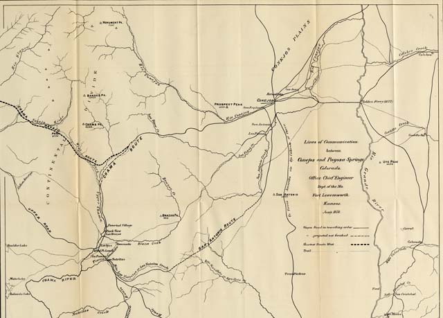
This map (Accession 2005:03012.1) forms part of the Southwest maps collection C 001 at the Center of Southwest Studies.
© 2005 Center of Southwest Studies,
Fort Lewis College
All rights reserved (click here for Property Rights Statement).
1000
Rim Dr., Durango, CO 81301-3999 ~ Phone
970-247-7126 ~ Fax 970-247-7422
Page revised: July 28, 2005